North Carolina
U.S. state / From Wikipedia, the free encyclopedia
Dear Wikiwand AI, let's keep it short by simply answering these key questions:
Can you list the top facts and stats about North Carolina?
Summarize this article for a 10 years old
North Carolina (/ˌkærəˈlaɪnə/ ⓘ KARR-ə-LIE-nə) is a state in the Southeastern region of the United States. The state is the 28th largest and 9th-most populous of the United States. It is bordered by Virginia to the north, the Atlantic Ocean to the east, Georgia and South Carolina to the south, and Tennessee to the west. Along with South Carolina, it makes up the Carolinas region of the East Coast. In the 2020 census, the state had a population of 10,439,388.[7] Raleigh is the state's capital and Charlotte is its largest city. The Charlotte metropolitan area, with a population of 2,595,027 in 2020,[8] is the most-populous metropolitan area in North Carolina, the 21st-most populous in the United States, and the largest banking center in the nation after New York City.[9] The Raleigh-Durham-Cary, NC Combined Statistical Area is the second-largest metropolitan area in the state and 32nd-most populous in the United States, with a population of 2,043,867 in 2020,[10] and is home to the largest research park in the United States, Research Triangle Park.
North Carolina | |
|---|---|
| Nickname(s): Tarheel State; Old North State | |
| Motto(s): | |
| Anthem: The Old North State[1] | |
 Map of the United States with North Carolina highlighted | |
| Country | United States |
| Before statehood | Province of North Carolina |
| Admitted to the Union | November 21, 1789 (12th) |
| Capital | Raleigh |
| Largest city | Charlotte |
| Largest county or equivalent | Wake |
| Largest metro and urban areas | Charlotte |
| Government | |
| • Governor | Roy Cooper (D) |
| • Lieutenant Governor | Mark Robinson (R) |
| Legislature | General Assembly |
| • Upper house | Senate |
| • Lower house | House of Representatives |
| Judiciary | North Carolina Supreme Court |
| U.S. senators | Thom Tillis (R) Ted Budd (R) |
| U.S. House delegation |
|
| Area | |
| • Total | 53,819 sq mi (139,390 km2) |
| • Land | 48,711 sq mi (126,161 km2) |
| • Water | 1,972 sq mi (5,108 km2) 9.5% |
| • Rank | 28th |
| Dimensions | |
| • Length | 500[2] mi (804 km) |
| • Width | 184 mi (296 km) |
| Elevation | 700 ft (210 m) |
| Highest elevation | 6,684 ft (2,037 m) |
| Lowest elevation (Atlantic Ocean[3]) | 0 ft (0 m) |
| Population (2022) | |
| • Total | 10,698,973 |
| • Rank | 9th |
| • Density | 219.64/sq mi (84.80/km2) |
| • Rank | 15th |
| • Median household income | $52,752[4] |
| • Income rank | 39th |
| Demonym(s) | North Carolinian (official); Tarheel (colloquial) |
| Language | |
| • Official language | English[5] |
| • Spoken language | As of 2010[6]
|
| Time zone | UTC– 05:00 (Eastern) |
| • Summer (DST) | UTC– 04:00 (EDT) |
| USPS abbreviation | NC |
| ISO 3166 code | US-NC |
| Traditional abbreviation | N.C. |
| Latitude | 33° 50′ N to 36° 35′ N |
| Longitude | 75° 28′ W to 84° 19′ W |
| Website | www |
| List of state symbols | |
|---|---|
 | |
 | |
| Motto | Esse quam videri ("To be, rather than to seem")[lower-alpha 1] |
| Slogan | First in Flight; First in Freedom (unofficial) |
| Song | "The Old North State" |
| Living insignia | |
| Amphibian | Pine Barrens tree frog |
| Bird | Cardinal |
| Butterfly | Eastern tiger swallowtail |
| Dog breed | Plott Hound |
| Fish | Red drum |
| Flower | Flowering dogwood |
| Insect | Western honey bee |
| Mammal | Eastern gray squirrel |
| Marsupial | Virginia opossum |
| Reptile | Eastern box turtle |
| Tree | Pine |
| Inanimate insignia | |
| Beverage | Milk |
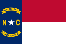
| Color(s) | Red and blue |
| Dance | Shag |
| Food | Scuppernong grape and sweet potato |
| Fossil | Megalodon teeth |
| Gemstone | Emerald |
| Mineral | Gold |
| Rock | Granite |
| Shell | Scotch bonnet |
| Other | Marbled salamander (salamander) |
| State route marker | |
 | |
| State quarter | |
 Released in 2001 | |
| Lists of United States state symbols | |
The earliest evidence of human occupation in North Carolina dates back 10,000 years, found at the Hardaway Site. North Carolina was inhabited by Carolina Algonquian, Iroquoian, and Siouan speaking tribes of Native Americans prior to the arrival of Europeans. King Charles II granted eight lord proprietors a colony they named Carolina after the king and which was established in 1670 with the first permanent settlement at Charles Town (Charleston). Because of the difficulty of governing the entire colony from Charles Town, the colony was eventually divided and North Carolina was established as a royal colony in 1729 and was one of the Thirteen Colonies. In 1755, colonial North Carolina received its first postmaster, James Davis, appointed by Benjamin Franklin.[11] The Halifax Resolves resolution adopted by North Carolina on April 12, 1776, was the first formal call for independence from Great Britain among the American Colonies during the American Revolution.[12]
On November 21, 1789, North Carolina became the 12th state to ratify the United States Constitution. In the run-up to the American Civil War, North Carolina declared its secession from the Union on May 20, 1861, becoming the tenth of eleven states to join the Confederate States of America. Following the Civil War, the state was restored to the Union on July 4, 1868.[13] On December 17, 1903, Orville and Wilbur Wright successfully piloted the world's first controlled, sustained flight of a powered, heavier-than-air aircraft at Kitty Hawk in North Carolina's Outer Banks. North Carolina often uses the slogan "First in Flight" on state license plates to commemorate this achievement, alongside a newer alternative design bearing the slogan "First in Freedom" in reference to the Mecklenburg Declaration and Halifax Resolves.
North Carolina is defined by a wide range of elevations and landscapes. From west to east, North Carolina's elevation descends from the Appalachian Mountains to the Piedmont and Atlantic coastal plain. North Carolina's Mount Mitchell at 6,684 ft (2,037 m) is the highest point in North America east of the Mississippi River.[14] Most of the state falls in the humid subtropical climate zone; however, the western, mountainous part of the state has a subtropical highland climate.[15]

